UN
19 Arundel Road
£ 240,000
Description
We don't have a Description for this property.
- Bedrooms
- 4
- Bathrooms
- 0
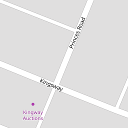

Leaflet © OpenStreetMap contributors
The heatmap indicates the level of crime in the area. The color of the heatmap indicates the crime severity and recency.
Metrics Year-on-Year
- Average area value
- 150,833.00 £Decreased by 50.30 %
- Average area rental value
- 638.00 £/moDecreased by 21.91 %
- Est rental Yield
- 5.08 %Increased by 57.28 %
- Crime Rate
- 12.00 %Unchanged by 0.00 %
from 303,493.00 £
from 817.00 £/mo
from 3.23 %
from 12.00 %
Nearby Schools
| Name | Type | Ofsted | Distance |
|---|---|---|---|
| Ansdell Primary School | Community School | Good | 0.45 KM |
| Lytham St Annes High School | Foundation School | Good | 0.67 KM |
| Clifton Primary School | Community School | Good | 1.35 KM |
| Aks Lytham | Other Independent School | 1.60 KM | |
| Lytham Hall Park Primary School | Community School | Outstanding | 2.45 KM |
Images
Nearby Streets
| Name | Average Price | Average Sqft | Distance |
|---|---|---|---|
| Ribble Point | £ 0 | 0 | 0.00 KM |
| Lake Point | £ 0 | 0 | 0.00 KM |
| Malvern Road | £ 249,950 | 0 | 0.00 KM |
| Lansdowne Road | £ 0 | 0 | 0.00 KM |
| Back Seymour Road | £ 0 | 0 | 0.00 KM |
Nearby Transport
| Name | NLC | TLC | Distance |
|---|---|---|---|
| Ansdell And Fairhaven | 2662 | AFV | 0.29 KM |
| Lytham | 2670 | LTM | 3.50 KM |
| St Annes-On-The-Sea | 2672 | SAS | 3.91 KM |
| Moss Side | 2675 | MOS | 6.38 KM |
| Squires Gate | 2666 | SQU | 7.23 KM |
Nearby Listings
| Address | Price | Type | Score | Distance |
|---|---|---|---|---|
| Critchley Place, Lytham St. Annes, FY8 | £ 275,000 | BUY | 8 / 10 | 0.13 KM |
| Lake Road North, Lytham St Annes | £ 549,950 | BUY | 6 / 10 | 0.15 KM |
| Clifton Drive, Lytham St. Annes, Lancashire, FY8 | £ 275,000 | BUY | 7 / 10 | 0.17 KM |
| Princes Road, Lytham St. Annes, FY8 | £ 575,000 | BUY | 7 / 10 | 0.18 KM |
| Clifton Drive, Lytham St Annes, Lancashire | £ 235,000 | BUY | 7 / 10 | 0.19 KM |
Nearby Properties
| Address | Price | Distance |
|---|---|---|
| 3 Arundel Road | £ 268,500 | 0.00 KM |
| 7 Arundel Road | £ 249,000 | 0.00 KM |
| 19 Arundel Road | £ 240,000 | 0.00 KM |
| 18 Arundel Road | £ 290,000 | 0.00 KM |
| 9 Arundel Road | £ 204,000 | 0.00 KM |